Thai PBS Verify found the source of the information from: Facebook
The Siege of El Fasher in central Sudan was a prolonged and violent military operation, primarily carried out by the Rapid Support Forces (RSF), aimed at capturing El Fasher — the capital of North Darfur, a city of strategic, administrative, and humanitarian significance. The siege cut the city off from food, water, medicine, and humanitarian aid. Civilian areas, including markets, hospitals, and displaced persons camps, have been repeatedly attacked.
Reports also included mass killings, sexual violence, extrajudicial executions, and widespread looting. After more than 500 days under siege, El Fasher was captured by the RSF on 26 October 2025, resulting in soaring numbers of deaths, injuries, and displaced people. The situation has raised deep concern within the international community that Darfur may once again face genocide. (Click to view the archived original content)
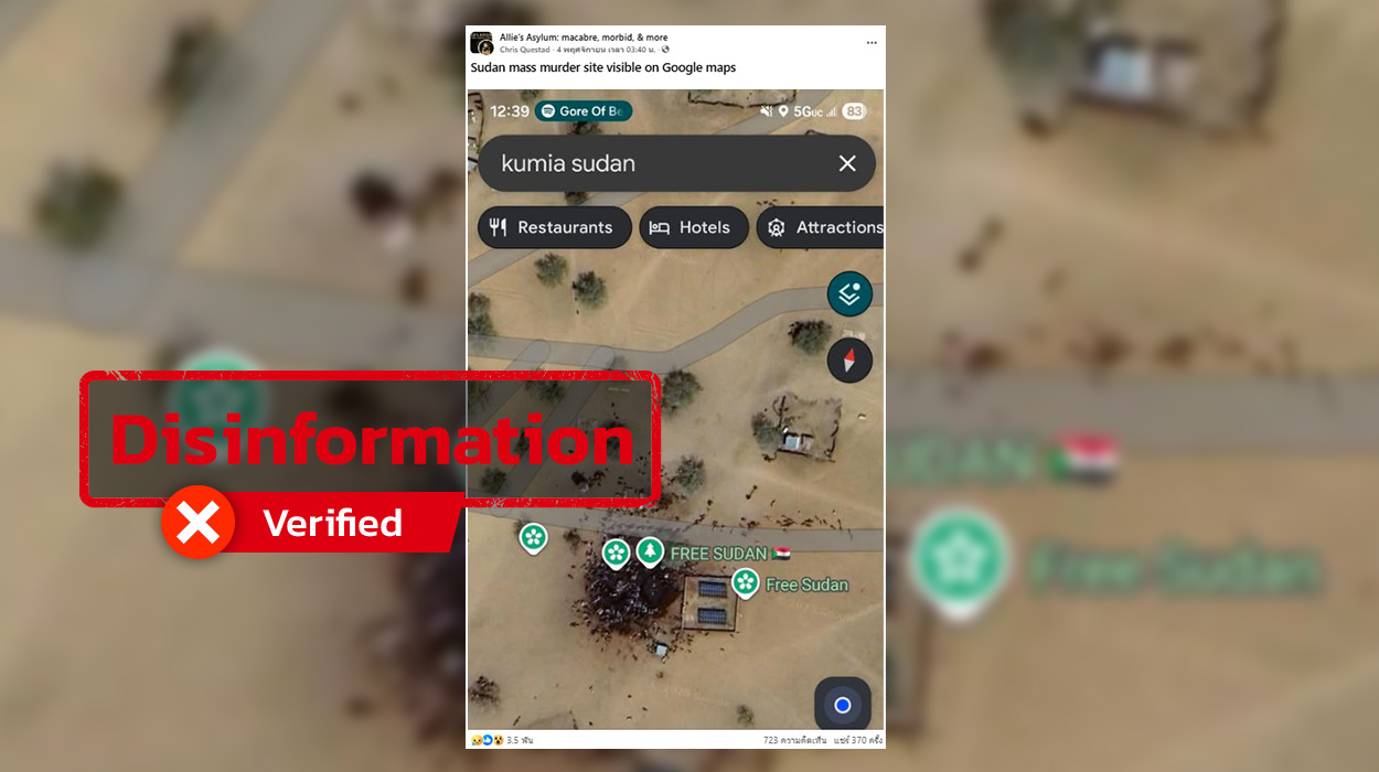
Thai PBS Verify found that a Facebook account named Chris Questad shared an image of a location on a map with the caption “Sudan mass murder site visible on Google Maps.” The caption in Thai reads: “สถานที่สังหารหมู่ซูดานปรากฏให้เห็นบน Google Maps”.
The post received 3,500 reactions, 715 comments, and was shared more than 368 times.
Similar content was also found circulating on Instagram and Threads.
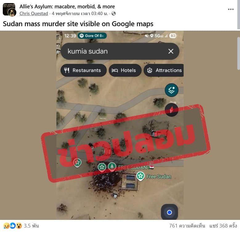
A Facebook post shared an image of a location on a map claiming it was a Sudanese mass-murder site.
What is this location?
Thai PBS Verify used the text shown in the image, “KUMAN SUDAN,” to search for the location on Google Maps. This led to the coordinates 10°57’39″N, 26°24’52″E.
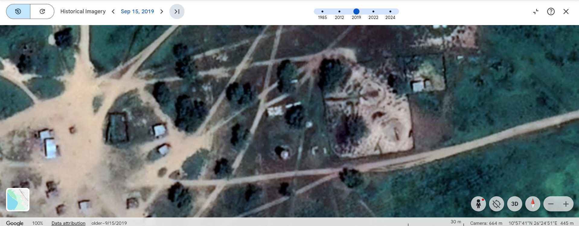
The coordinates were then checked on Google Earth, using satellite images from 1985–2012, which showed the area was empty land. In 2016, construction appeared for the first time, and satellite imagery documents its development up to the most recent images in 2024.
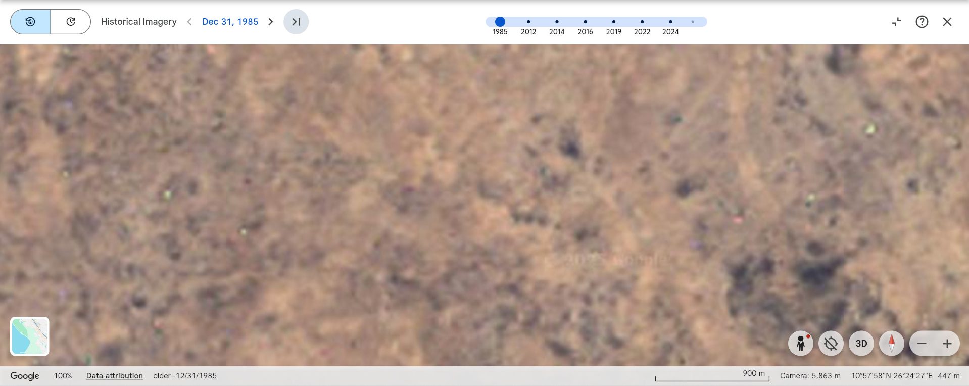
A map image in the post showing the location in 1985.
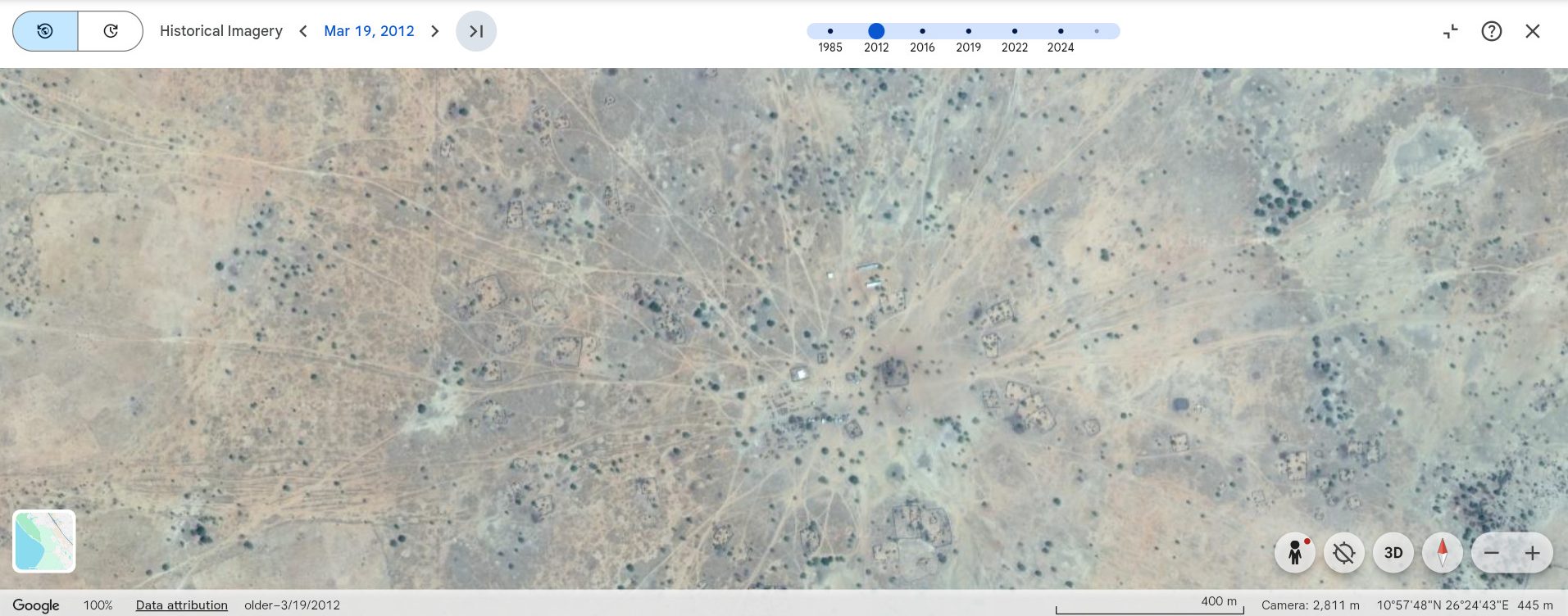
A map image in the post showing the location in 2012.
A map image in the post showing the location in 2016
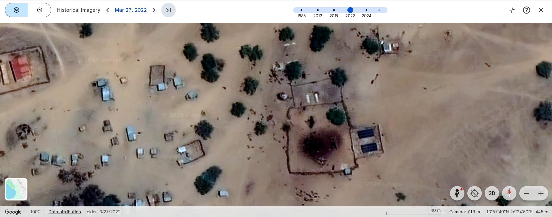
A map image in the post showing the location in 2022
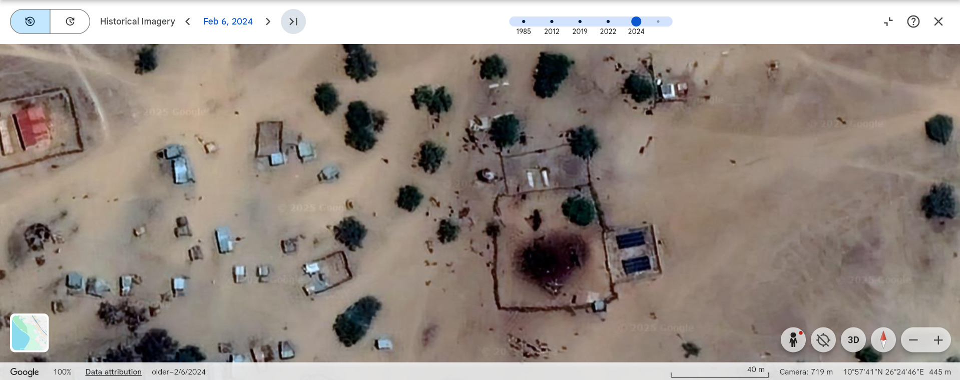
A map image in the post showing the location in 2024.
Comparing the images from 1985 and 2012 shows the area was forested, and by 2016 it had begun to develop into a livestock farm — long before the military operations by the Rapid Support Forces (RSF) that took place in 2023.
A check on Bing Maps also shows the area enclosed by fencing, with shapes resembling animals visible around the site.
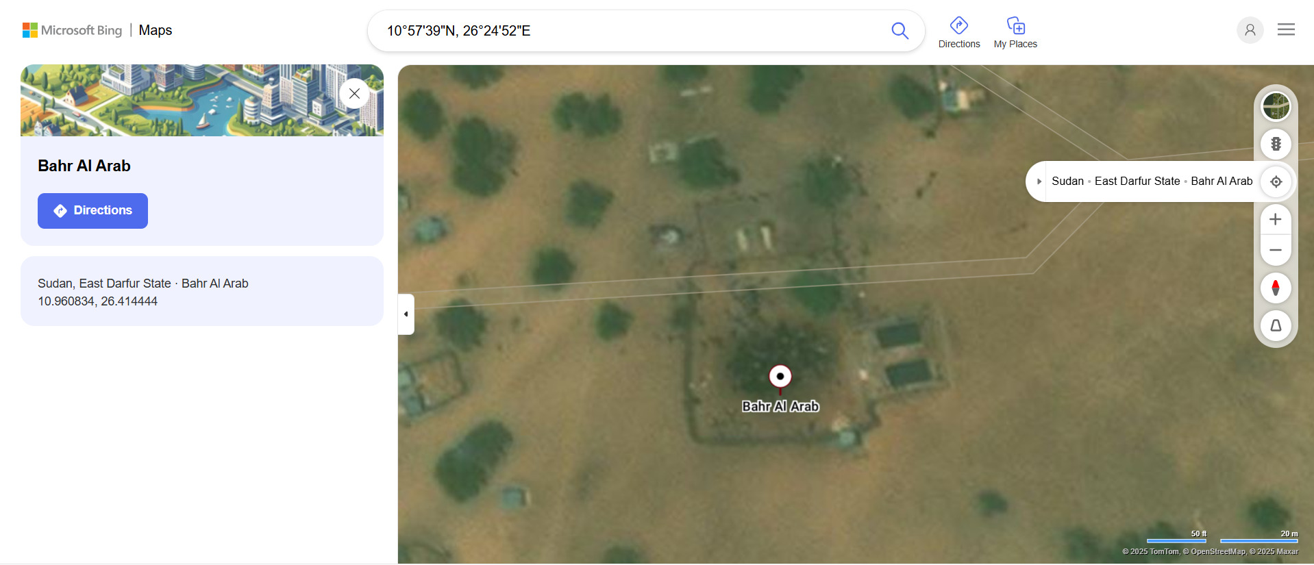
A Bing Maps image, when compared with the maps published by the Humanitarian Research Lab (HRL) at YSPH showing locations related to the RSF siege of El Fasher, confirms that the two areas are completely different. (Click to view the archived original content)
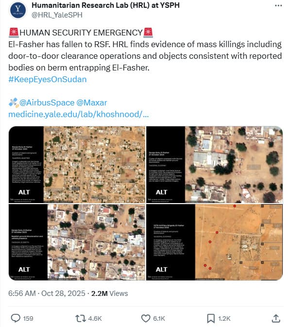
A map showing the RSF siege of El Fasher by Yale University.
What appears in the map?
Thai PBS Verify contacted Nathaniel Raymond, Director of the Humanitarian Research Lab at Yale University, via email. The lab uses satellite imagery, open-source intelligence (OSINT), and field data analysis to investigate human rights violations, conflicts, and war crimes worldwide.
He clarified that the shapes seen in the image are cattle, not bodies as claimed in the post. (Click to view the archived original content)

Nathaniel Raymond, Executive Director, Humanitarian Research Lab of University of Yale